


Voting District 44545, San Bernardino County, California
About
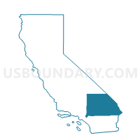
Outline

Summary
| Unique Area Identifier | 539073 |
| Name | Voting District 44545 |
| County | San Bernardino County |
| State | California |
| Area (square miles) | 2.81 |
| Land Area (square miles) | 2.81 |
| Water Area (square miles) | 0.00 |
| % of Land Area | 100.00 |
| % of Water Area | 0.00 |
| Latitude of the Internal Point | 34.08204890 |
| Longtitude of the Internal Point | -117.69553250 |
Maps


Graphs
Select a template below for downloading or customizing gragh for Voting District 44545, San Bernardino County, California


Neighbors
Neighoring Voting District (by Name) Neighboring Voting District on the Map
- Voting District 10000, Los Angeles County, CA
- Voting District 21720, San Bernardino County, CA
- Voting District 21750, San Bernardino County, CA
- Voting District 21760, San Bernardino County, CA
- Voting District 21900, San Bernardino County, CA
- Voting District 44550, San Bernardino County, CA
- Voting District 44780, San Bernardino County, CA
- Voting District 44800, San Bernardino County, CA
- Voting District 56156, Los Angeles County, CA
Top 10 Neighboring County Subdivision (by Population) Neighboring County Subdivision on the Map
- East San Gabriel Valley CCD, Los Angeles County, CA (935,875)
- Ontario CCD, San Bernardino County, CA (615,598)
Top 10 Neighboring Place (by Population) Neighboring Place on the Map
- Ontario city, CA (163,924)
- Pomona city, CA (149,058)
- Upland city, CA (73,732)
- Montclair city, CA (36,664)
- Claremont city, CA (34,926)
Top 10 Neighboring Elementary School District (by Population) Neighboring Elementary School District on the Map
Top 10 Neighboring Secondary School District (by Population) Neighboring Secondary School District on the Map
Top 10 Neighboring Unified School District (by Population) Neighboring Unified School District on the Map
- Pomona Unified School District, CA (166,671)
- Upland Unified School District, CA (73,518)
- Claremont Unified School District, CA (41,252)
Top 10 Neighboring State Legislative District Lower Chamber (by Population) Neighboring State Legislative District Lower Chamber on the Map
- Assembly District 63, CA (514,285)
- Assembly District 59, CA (481,561)
- Assembly District 61, CA (441,000)
Top 10 Neighboring State Legislative District Upper Chamber (by Population) Neighboring State Legislative District Upper Chamber on the Map
- State Senate District 31, CA (989,662)
- State Senate District 32, CA (946,010)
- State Senate District 29, CA (881,748)
Top 10 Neighboring 111th Congressional District (by Population) Neighboring 111th Congressional District on the Map
- Congressional District 43, CA (735,581)
- Congressional District 26, CA (691,452)
- Congressional District 38, CA (641,410)
Top 10 Neighboring Census Tract (by Population) Neighboring Census Tract on the Map
- Census Tract 10.02, San Bernardino County, CA (5,530)
- Census Tract 10.01, San Bernardino County, CA (4,990)
- Census Tract 2.05, San Bernardino County, CA (4,736)
- Census Tract 4027.03, Los Angeles County, CA (4,686)
- Census Tract 2.07, San Bernardino County, CA (4,635)
- Census Tract 4019.01, Los Angeles County, CA (4,610)
- Census Tract 2.03, San Bernardino County, CA (4,474)
- Census Tract 2.01, San Bernardino County, CA (4,195)
- Census Tract 2.08, San Bernardino County, CA (4,124)
- Census Tract 4027.06, Los Angeles County, CA (3,945)